
We have a cool and cloudy day ahead with showers developing west to east as a frontal boundary pushes through New England.
Expect to see the steadiest shower activity breaking out from west to east through the mid-afternoon with the greatest threat for showers from western Maine, southwest into New Hampshire, central Massachusetts, and into Connecticut, just to the east of that, a few stray showers and sprinkles are possible, but most remain dry.
The steady showers shift eastward into the Boston area after 5 p.m. and eventually arrive down the Cape by early Sunday night.
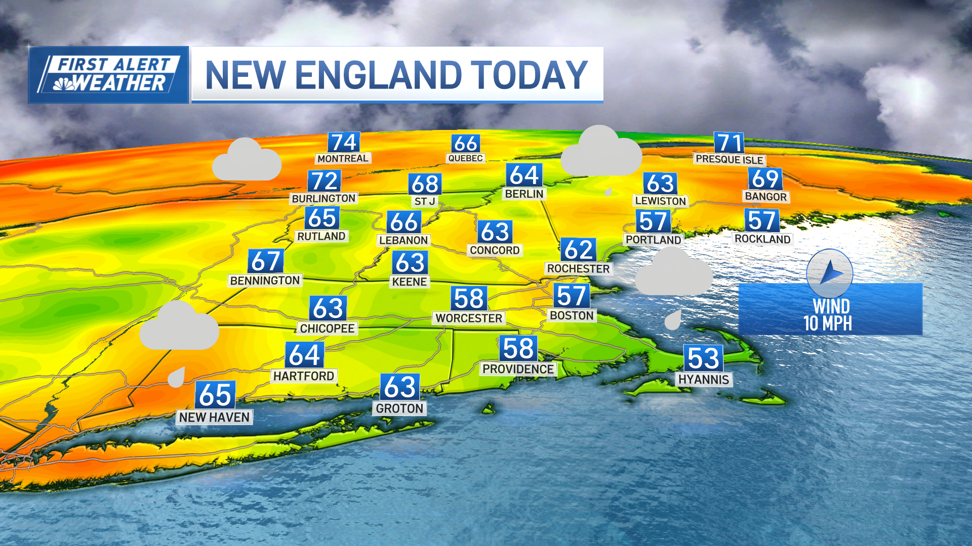
Wind will be onshore out of the southeast 10-15mph, with higher gusts toward the Cape.
Get Boston local news, weather forecasts, lifestyle and entertainment stories to your inbox. Sign up for NBC Boston’s newsletters.

Highs will be mostly in the low to mid 50s, slightly cooler immediate coast and higher elevations, and in the 60s northern Maine ahead of the action.
Showers continue overnight with a few heavy downpours and thunderstorms embedded, and finally exit the coastline by the morning commute, except for the Cape where showers will linger into the early afternoon hours, about .25-.50” of rain is expected. Low temps will be mid 40s to low 50s.

Wind turns more out of the south Monday allowing temperatures to jump into the low 70s (locally cooler immediate coast) by the afternoon with clouds and sunny breaks,an isolated afternoon shower or thunderstorm possible, but most stay dry.
Tuesday will be much drier with temperatures soaring well into the 70s, however, we’ll have to watch the coastline in the afternoon where sea breezes are expected to develop cooling off the coast once again.

Turning unsettled Wednesday as another frontal boundary moves into New England bringing more showers and thunderstorms along with cooler temperatures. We stay unsettled right through the weekend, as it looks now, with cooler temps and the risk for showers each day with some dry times as well, which is featured on our Exclusive 10-Day Forecast.
Weather

Have a safe and healthy Cinco de Mayo!
